![]()
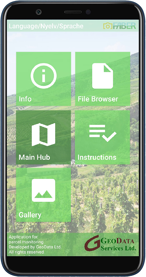
The mobile application
that simplifies field control
The inspiration behind the creation of FABER was the idea to have a single platform for taking pictures and certifying the existence of the declared crop. FABER provides a suitable solution for ground-truth certification of location-based agricultural subsidies.
With the aid of the application – after registration – one can simply take certified photographs of their parcels. Beyond the visual content of these pictures, the registration of the location and time of taking the photo, ID of the user and the plot’s unique ID serve for further certification.

Taking
certified photos
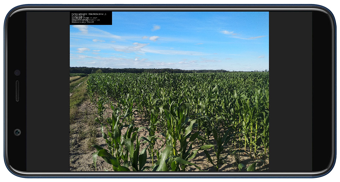
The definition and recording of the location and circumstances of taking the photo ensure that the pictures were indeed taken of
the given parcel.
⇒ See more…

Clear traceability of certification process
Clear symbolization of spatial data, together with listing of parcels and their respective photos support the transparency of the progress of certification.
⇒ See more…

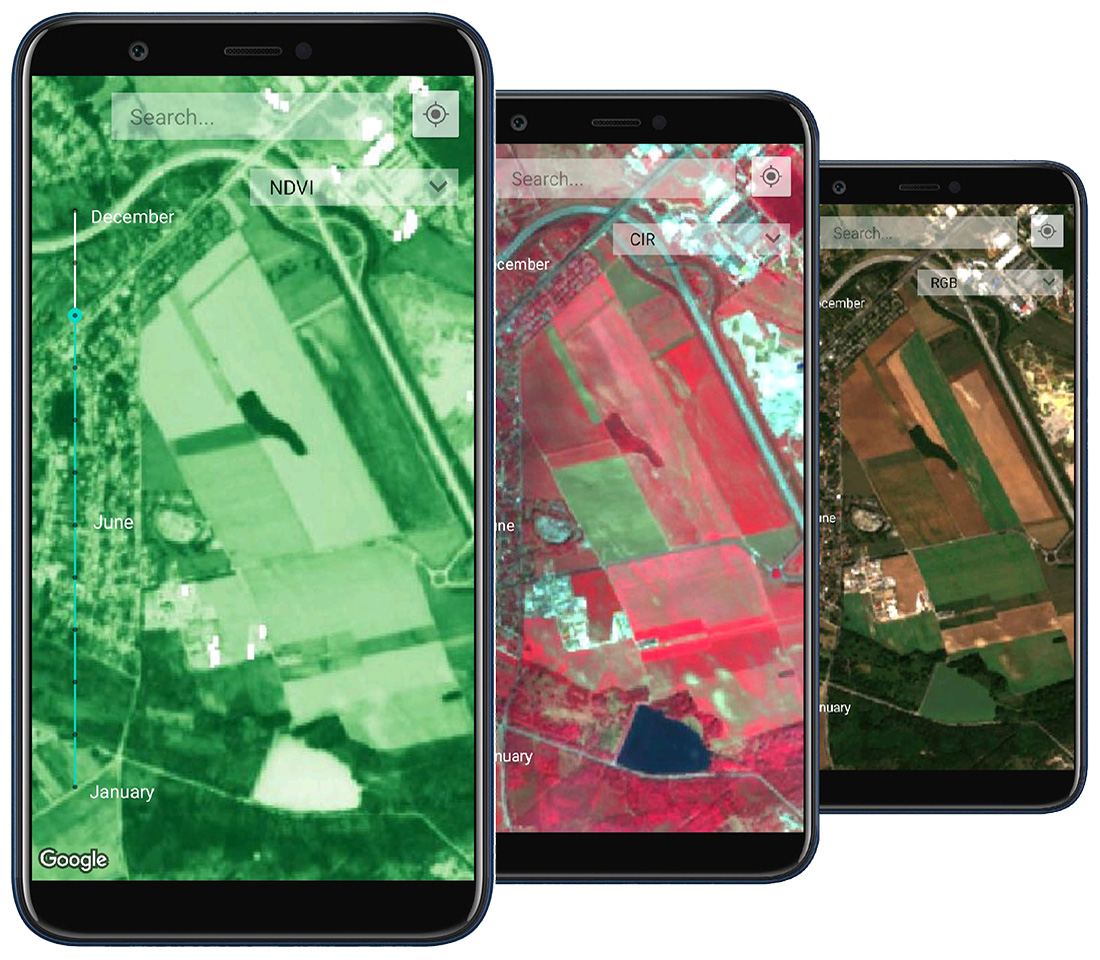
Displaying time-series data regarding the parcels
Satellite images for every month
of the selected period provide
a way of tracing the changes
occurred on the respective
plot.
⇒ See more…

Offline
operation
With the possibility of downloading spatial data, it is granted that the application is operational even when the internet connection is
poor on the field.
⇒ See more…
Taking reliable, certified photographs
- photos can only be taken on certain conditions:
- during the daytime
- on a pre-defined location
- in rotation angles calculated by the application
- capture of certification data in two ways:
- burnt into the (output) image
- among the metadata of the picture
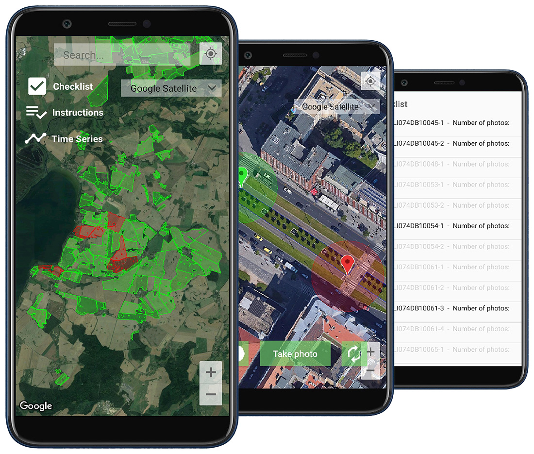
Simple, versatile traceability
- based on the symbology of parcels, certified areas are visible
- the number of taken pictures can be seen on the checklist
- output images can be viewed inside the app
- pictures can be uploaded for inspection with a single click
Checking the status of parcels on satellite images
- changes of the parcels can be traced based on the latest satellite images
- continuous data service is provided by the Sentinel-2 satellite programme of the European Space Agency (ESA)
- images for the current year are continuously updated
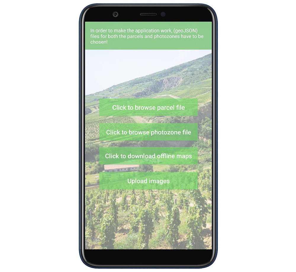
Completely offline operation
- during the inspection, the internet may be unavailable in the respective region
- the application is operational regardless the internet connection after the one-time download of spatial data
Further functions:
Change language (Hungarian, English, German)
Send feedback
Photo gallery
Change of basemaps
Detailed instructional manual
Search function on the parcel IDs
Display of the location of taken photos
e-mail: info.faber@geoadat.hu
![]()